![]()
by matthew j. nelson

for nearly a decade i have been intrigued by the dos cabezas mountains in southeastern arizona. the first time i consciously noticed them was on the morning of january 1, 2000. from high within the galiuro mountains east of tucson i waited in the darkness for the sun to rise on the new millenium. i mistakenly assumed the sun would appear somewhere over mt. graham in the pinale�o mountains, a peak sacred to all of southern arizona�s tribes. but as the giant orange star lit up the horizon, it rose between a two-headed peak that i had never really noticed before � the dos cabezas.
it would be more than eight years before i finally explored the twin peaks just two hours from tucson. nestled near the borders of arizona, new mexico and mexico, the dos cabezas mountains are a hidden treasure that should be high on your list of places to visit this season.
the drive from tucson to the foothills of the dos cabezas is spectacular. after crossing the san pedro river near the town of benson the landscape slowly begins to transform from the familiar sonoran desert we know and love to the neighboring chihuahuan desert. yuccas begin to appear, first as a few bushy-headed aliens among the grasses and prickly pear cacti. before long they become the dominant species.
as you climb away from the san pedro river valley you�ll soon enter texas canyon, the picturesque pass where granite boulders appear to have erupted out of the earth. this is a particularly impressive collection of rocks, and it would be a great destination if it weren�t for its proximity to i-10 and a popular rest area. despite signs warning not to deface the rocks and ongoing graffiti removal efforts, brightly colored names and messages spray painted onto the rocks is still common. texas canyon is perhaps best know for its nearby attraction, the thing. this roadside tourist trap has become part of the culture of the southwest due to the 247 cryptic billboards extending hundreds of miles away from this lonely spot on the map. if you�ve never stopped to check out �the mystery of the desert,� it might be worth the $1 admission. i�ll leave that up to you.
near the town of willcox, look south and admire the massive willcox playa. if you visit in early september the ancient lakebed might seem like a mirage shimmering in the morning light. after a long summer of monsoon storms, the playa fills with rainwater and takes on the appearance of the giant lake it once was. although it�s only an inch deep in most places, the big blue image is a refreshing contrast to the playa�s normal dusty and barren character.
look east and the prominent dos cabezas dominate the skyline. the twin summits are among the most dramatic peaks in southeastern arizona, and beckon hikers to scramble near vertical rock to over 8,350 feet above sea level. we�ll save that adventure for another time. for now, continue heading toward to the town of bowie where you�ll access the seldom-visited southeast corner of the dos cabezas mountains. from a distance it appears that the only granite you might find within these mountains are on the cabezas themselves, but after turning south on apache pass road (see �finding your way� for specific directions) you�ll see a wilderness of rocks appear before you.
reminiscent of the coyote mountains near kitt peak, the eastern foothills of the dos cabezas is breathtaking. balanced rocks, hoodoos and massive faces of every imaginable shape and size can be found in this tiny yet spectacular piece of wilderness. hidden among the granite boulders is the indian bread rocks picnic area, the perfect destination for a day of hiking, rock scrambling and exploration.
the picnic area has a few basic amenities, including a few picnic tables, bar-b-que pits and a toilet. the area appears well maintained yet rarely used. my sense is that it is an occasional destination for families from bowie and willcox, but other than that i doubt anyone you know has ever even heard of indian bread rocks. there is plenty of evidence among the boulders that apaches and other native peoples once lived and hunted here, but don�t be fooled by the rock art on the slabs near the picnic tables. these are modern petroglyphs, also known as graffiti.
although no official hiking trails exist within the 11,700-acre dos cabezas mountain wilderness, the area around indian bread rocks is ideal for cross-country wandering. the coarse-grain granite grips shoe rubber particularly well, so walking up steep angles is easier than you might think. to begin your exploration, hike immediately east of the picnic area up the 30-degree granite slab and within minutes you�ll be able to soak up outstanding views of the san simon valley to the northeast. if you look to the west you�ll begin to get a sense of the myriad layers of granite that comprise indian bread rocks. pick your next destination and start walking.
for those comfortable with bouldering and rock scrambling, the potential within indian bread rocks is unlimited. within a few minutes of the picnic area you�ll find dozens of prominent boulders that can easily be scaled with just a few confident moves. the south faces of many boulders sport huecos, or wind and rain carved cups, that make ascending the rocks much easier than their featureless north sides. just remember, climbing down is harder than climbing up.
just like at cochise stronghold in the dragoon mountains, the more you explore indian bread rocks the more you�ll discover. desert gardens appear on hidden terraces and atop individual boulders themselves, and tiny fissures act like canyon ecosystems within this multi-layered jumble of rocks. the terrain is relatively easy to walk through, except for some thick patches of prickly pear and acacia trees that should be avoided.
the biodiversity here is remarkable. at just over 4,000 feet indian bread rocks is perfectly suited to support plants from both the upper sonoran and transition zones. the abundance of food and medicine plants makes it an ethnobotanist�s dream come true; there�s prickly pear pads (nopales) and fruit (tunas), barrel cactus fruit, cholla buds, mesquite beans, jojoba, and acorns (bellotas) from nearby oak trees, to name a few. the nearby mountains rise thousands of feet above the valley floor and support a large population of deer, javelina and other game animals. jaguars have even been spotted here. it�s no wonder why people once lived among the rocks.
keep your eyes on the ground as you walk along and you�ll likely see evidence of those who came before us. decorated potsherds, flaked stone and other artifacts hide within the granitic sand, and one particular area has five bedrock mortars (metates) where people used to sit and grind mesquite beans and acorns. as an aspiring archaeologist, i believe that there is nothing more exciting than finding a little piece of history while out in nature. it�s an opportunity to connect with someone who walked across the same landscape as you, many hundreds of years before. as with all treasures, they should be left right where you find them. too many pieces of history have been stolen from the public lands of arizona and the southwest. by removing an artifact from the place where you found it, you deprive future generations of the same wonderful discovery that you enjoyed. and once it�s on your desk at home, it will likely never be seen again. �leave what you find� is a core principal of leave no trace ethics, and is particularly important when it comes to artifacts.
often times wandering off-trail without a specific destination is the best way to experience a new place. trail walking encourages the all-too-common practice of putting your head down and marching until you�ve reached your destination. but with wandering you soak up every step of the journey; your senses are heightened and constantly stimulated. some visitors to indian bread rocks will hike for about ten minutes outside the picnic area while others may amble for many hours to the upper regions of the granite paradise. it�s a perfect destination for families, offering plenty of adventure and discovery for hikers of all ages and abilities.
the dos cabezas mountains are just one of the many hundreds of sky island mountain ranges in arizona. each is unique and beautiful, remote and wild, and on any given day you�re likely to see more red-tailed hawks and desert spiny lizards than humans.
finding your way
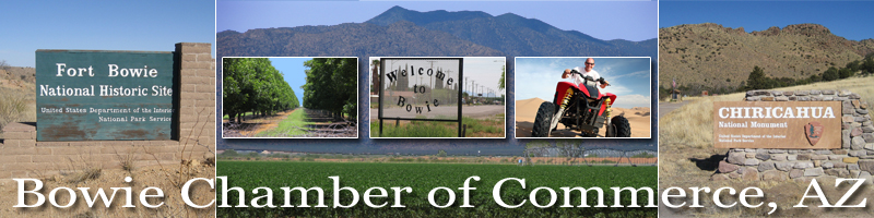
from tucson, head east on i-10 toward el paso. twenty miles east of willcox, exit the freeway at the town of bowie (exit 362). take the frontage road into downtown bowie and turn right (south) on apache pass road toward fort bowie. drive south for 4.4 miles past the pistachio groves, then turn right (west) on happy camp canyon road. follow this well-maintained dirt road for three miles, then turn left (south) into indian bread rocks picnic area. the blm wilderness sign makes it very easy to find.
matthew j. nelson is a nature writer, professional outdoor guide and sonoran desert devotee with a penchant for granite boulders.
this article was originally published in the september 2008 issue of the desert leaf.