![]()
by matthew j. nelson

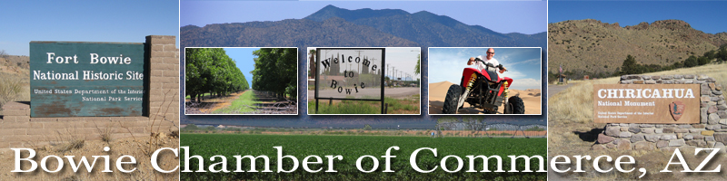
the chiricahua mountains of southeastern arizona were the inspiration for the term sky island, a moniker that's been given to all the beautiful mountains of the southwest that rise like islands out of the sea of desert and grassland. located at the crossroads of the sonoran desert, chihuahuan desert, rocky mountains and sierra madre, the biodiversity of the chiricahuas is unlike any other. in all, there are 8 amphibians, 46 species of reptiles, 71 species of mammals and more insects than people have been able to accurately document. over 300 bird species have been found in the chiricahua mountains, making it one of the most important bird habitats in north america. a total of over 1,000 plant species grow here, many of which are found nowhere else on earth. the chiricahuas are, in my opinion, one of the great natural wonders of the world.
within this massive mountain range exist unlimited hiking, backpacking, caving and birding opportunities. from the lush canyons of the eastern chiricahuas near portal to the dense pine and spruce forests near chiricahua peak, there is more adventure to be found here than you can imagine. most of the magic, however, is concentrated on the northern end of the mountain range inside chiricahua national monument.
despite its remote location, chiricahua national monument has something for everyone - a visitor center, camping and picnicking facilities, a wheelchair accessible route, and many miles of well-built trails that allow you to explore this natural wonderland. after stopping in at the visitor center, continue up bonita canyon drive to the road's end at massai point. at 6,870 ft. elevation, this is an excellent place to begin your adventure. there are numerous options from here, and your ambition and endurance will likely determine which route you follow.
all the hikes within the monument are beautiful, but it doesn't get any better than the heart of rocks trail. this is one of the most visually stimulating hikes in all of arizona, but in order to get there you'll have to do some trekking through equally gorgeous terrain. there are a few ways to get there, but my recommendation is a 9.8-mile loop that soaks in a little bit of everything that the chiricahuas have to offer.
start at massai point and locate the trailhead on the northwest end of the parking lot. within the first few steps you'll be mesmerized by the scene in front of you - a vast wilderness of lichen-covered hoodoos of all shapes and sizes. you could sit here all day and not grow tired of the myriad formations that seem to morph with the changing light. descend the massai nature trail, and at the first intersection, turn right and hike north for .3 miles. at the canyon bottom, turn left and follow the ed riggs trail for .7 miles down a beautiful drainage. unfamiliar trees like the apache pine and arizona cypress begin to appear, a reminder that you are in a special place. this section of the hike passes quickly, as you lose almost 500 feet of elevation in less than a mile.
at the next intersection, turn right on the hailstone trail. this expertly carved route contours along the hillside and affords hikers amazing views into rhyolite canyon. the distant hoodoos are some of the most spectacular, and with a little imagination you'll identify cartoon characters, mythic figures and other objects that are embodied by the towers of stone. one of the most impossible looking formations is the totem pole; 137 feet high and only 3 feet wide.
the hailstone trail ends after .8 miles; turn left and hike east on the upper rhyolite canyon trail. as it descend through the manzanita and white oak forest and into the canyon proper, you'll be thrust in a completely different environment. the giant sycamore and madrone trees of rhyolite canyon are absolutely impressive, and may be some of the largest you'll ever see. this is a great place to look for animals foraging in the leaf litter, and if you're lucky enough you might spot a chiricahua fox squirrel (sciurus nayaritensis chiricahuae), a species completely unique to this mountain range.
the rhyolite canyon trail, along with most of the trails featured on this hike, is the handiwork of the civilian conservation corps (ccc). in 1934, dozens of young men constructed roads, trails and facilities throughout the monument. their work has stood the test of time, and is currently being improved upon by trail crews from the coronado national forest. after hiking around the formidable terrain of the chiricahuas you'll be able to appreciate the amount of labor necessary to carve paths through this wild wilderness.
at the next intersection, turn left on the sarah deming trail and begin climbing out of rhyolite canyon. this section will elevate your heart rate, but the diverse forest, beautiful rock formations and abundant wildlife will keep you inspired. just when your legs need a rest, look for a perfectly carved rock bench on the right-hand side of the trail. climb a bit higher and soon you'll reach the intersection of the big balanced rock trail and the heart of rocks loop. this is where the wonder really begins.
start by hiking down the heart of rocks loop. at the first arroyo, turn left and follow a faint trail through the labyrinth of rhyolite formations. with the help of ed riggs, the ccc constructed this trail in order to take visitors on an up-close-and-personal tour of the famous rocks hidden inside chiricahua national monument. the narrow path winds among giant hoodoos, some of which are named: old maid, camel's head, thor's hammer, punch and judy, duck on a rock, kissing rocks. hundreds of unnamed rocks exist, and after staring at them for a while you'll probably assign names to a few.
the 1.1-mile trail ends all too soon, and you'll probably be tempted to hike it a second time. i certainly don't discourage it, as i have found new and beautiful discoveries every time i have hiked through the heart of rocks.
as you return to the big balanced rock trail, hike east toward the trail's namesake - a 1,000-ton boulder perched atop a tiny platform. it looks like a giant dradel that suddenly stopped spinning. after spending some time in awe of the big balanced rock, continue for one mile along this scenic and relatively flat route. as you lose the distant views and return to the cover of the forest, look for the inspiration point trail heading north. the 1-mile roundtrip hike takes you to my favorite place within chiricahua national monument. i have talked with many hikers that skipped this out-and-back trail for one reason or another, but the hike to inspiration point is breathtaking. don't miss it!
inspiration point is perched on the edge of upper rhyolite canyon, and for the first time you are given a panoramic view of this wonderland of rocks better than anything else you'll find within the monument. the likeness of the hoodoos to people is almost unbelievable, and armies of them line up along the canyon like guardians of these sacred mountains. if there was ever a spot where the chiricahua mountains revealed their magic and beauty, this is it. sunset at inspiration point is something you'll never forget and the fading light of day seems to bring the rocks to life.
after leaving inspiration point, hike .5 miles back to the intersection and turn left on the mushroom rock trail. this trail is 1.2 miles long and will bring you back around to the ed riggs and hailstone trails where you started many hours before. the last big formation to gawk at along the way is mushroom rock, which you really have to see to believe.
at the intersection with the ed riggs trail, turn right and hike up the canyon for .7 miles. be careful not to miss the last crucial turn to the right, which leads you back to massai point. otherwise, you'll end up at the echo canyon picnic area.
a hike through chiricahua national monument is a healthy workout for your body, a delightful treat for the imagination, and as many visitors have found, an opportunity to connect with nature on a deeper level. i'm convinced there is a reason the stone sentinels of rhyolite canyon are guarding the mountains, and after spending some time here perhaps you'll find the answer.
finding your way
from tucson, head east on i-10 toward el paso. at willcox (exit 336), exit the interstate and follow the frontage road into the town of willcox. turn right (south) on highway 186 at the sign for chiricahua national monument. enjoy the scenic drive through the grasslands for 31 miles, then turn left (east) on highway 181. the visitor center is just 6 miles beyond this intersection. to reach the heart of rocks trail, drive up bonita canyon road for 8 miles to massai point.
matthew j. nelson is a nature writer, professional outdoor guide and sonoran desert devotee who considers the chiricahua mountains among his favorite places on earth.
this article was originally published in the january 2009 issue of the desert leaf.